Project Highlights
Data Visualizations
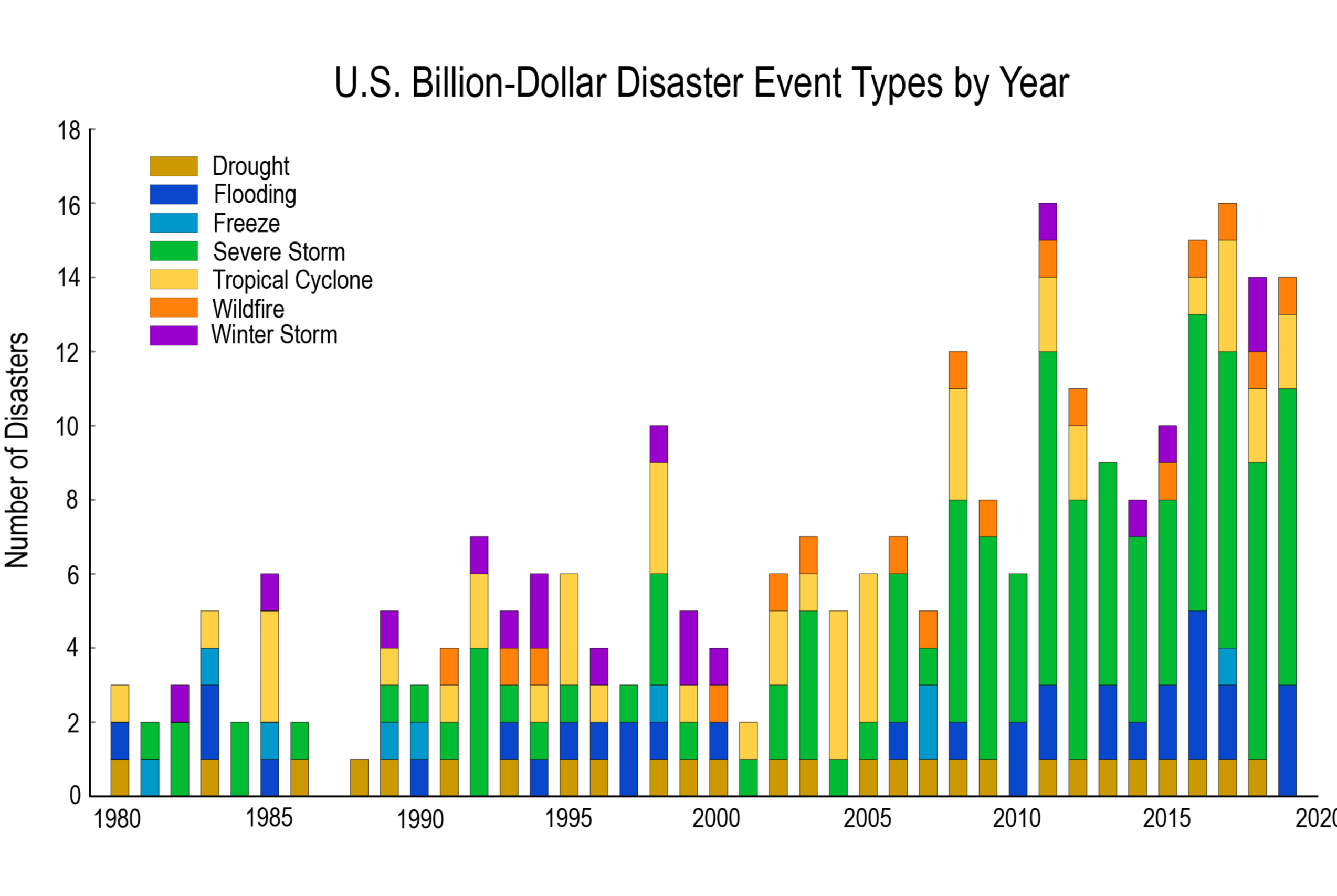
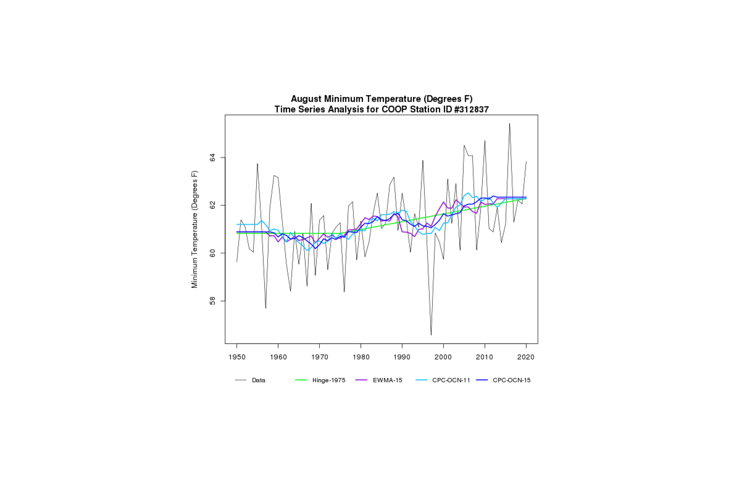
Climate Indicators
The North Carolina Institute for Climate Studies (NCICS) hosts a platform that delivers key climate information highlighting the Program’s data and providing technical input for reports such as the National Climate Assessment. NEMAC works with the NCICS team to develop static and dynamic graphics that help communicate these key climate messages.
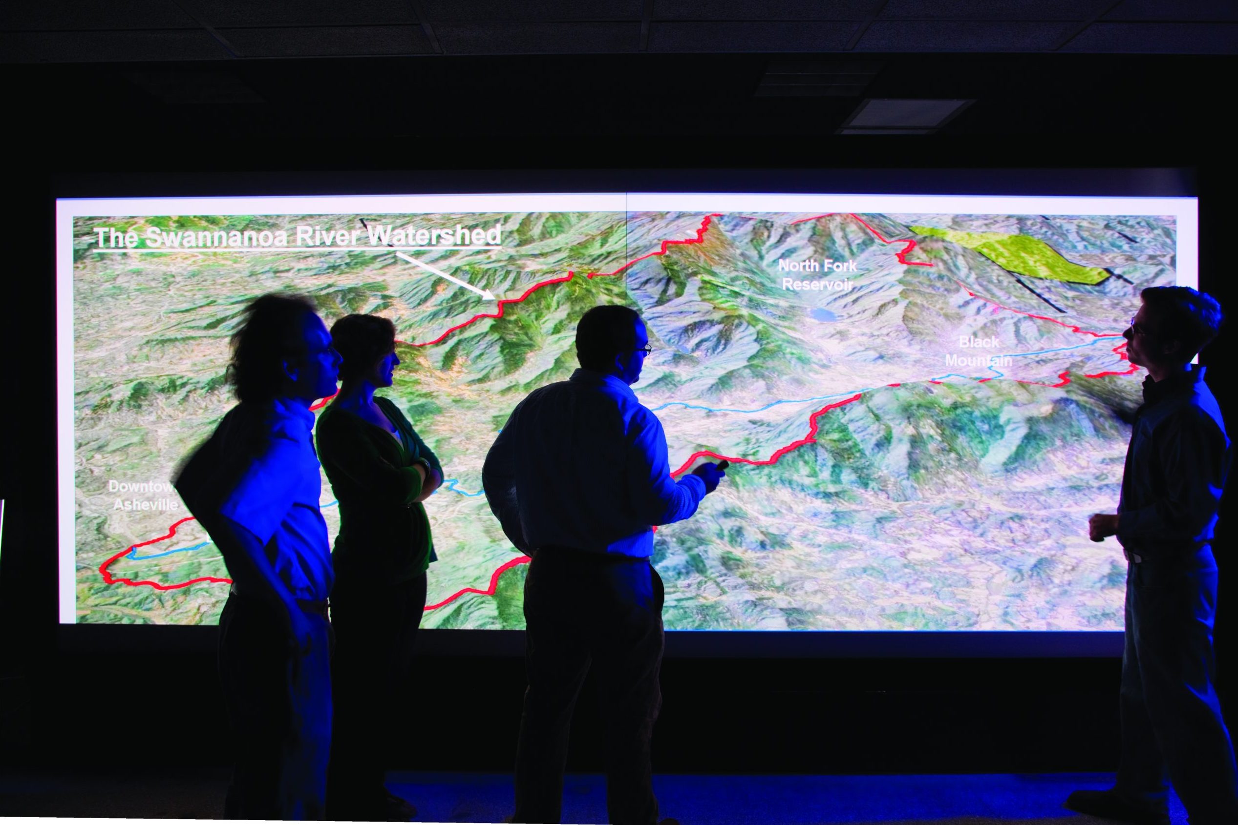
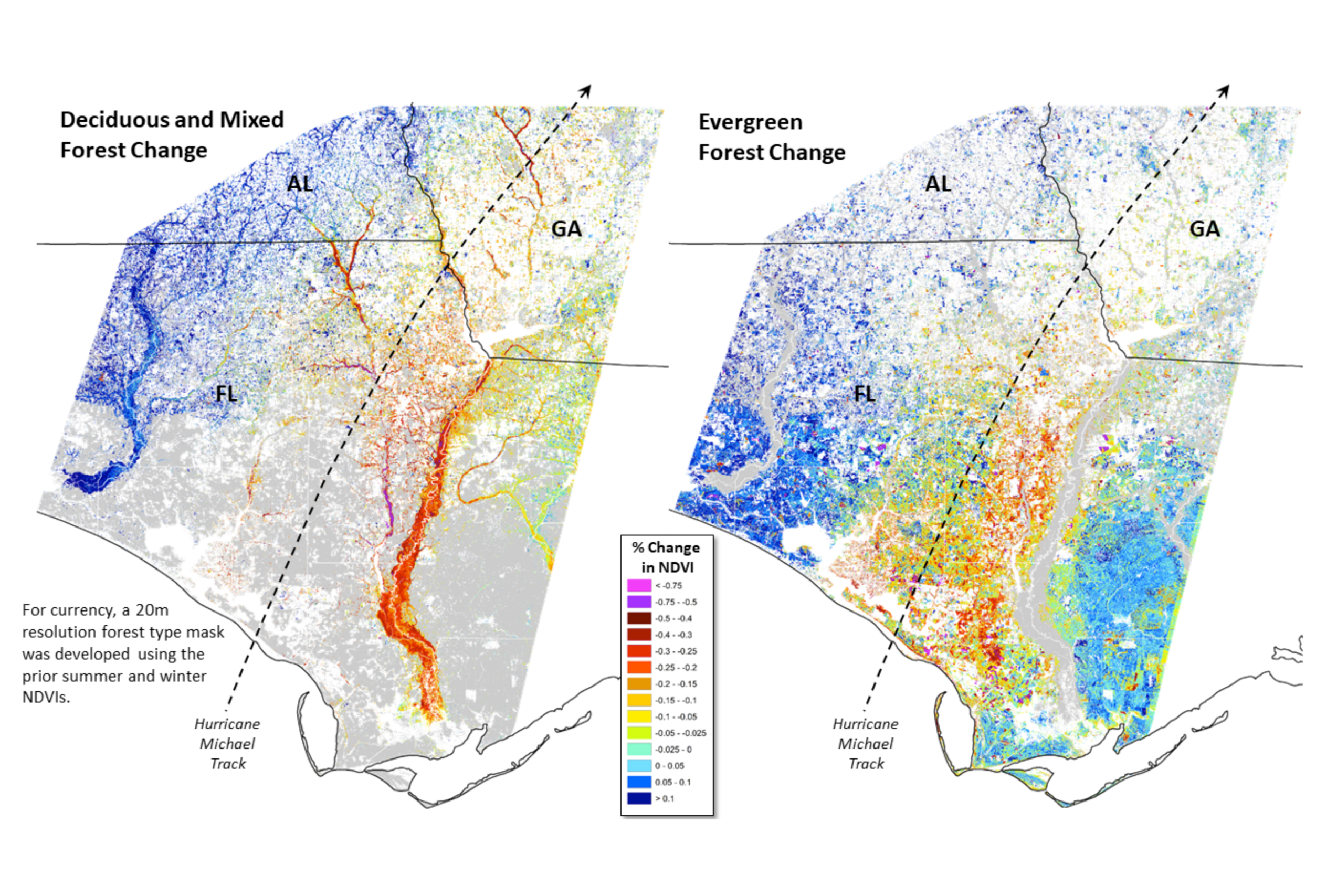
Landscape dynamics assessment tool (LanDAT)
The Landscape Dynamics Assessment Tool (LanDAT) is used to assess landscape dynamics based on satellite-observed vegetation change. NEMAC, together with the U.S. Forest Service’s Eastern Forest Environmental Threat Assessment Center, developed LanDAT to assist planners and resource managers in understanding and incorporating landscape resilience and vulnerability into project planning.
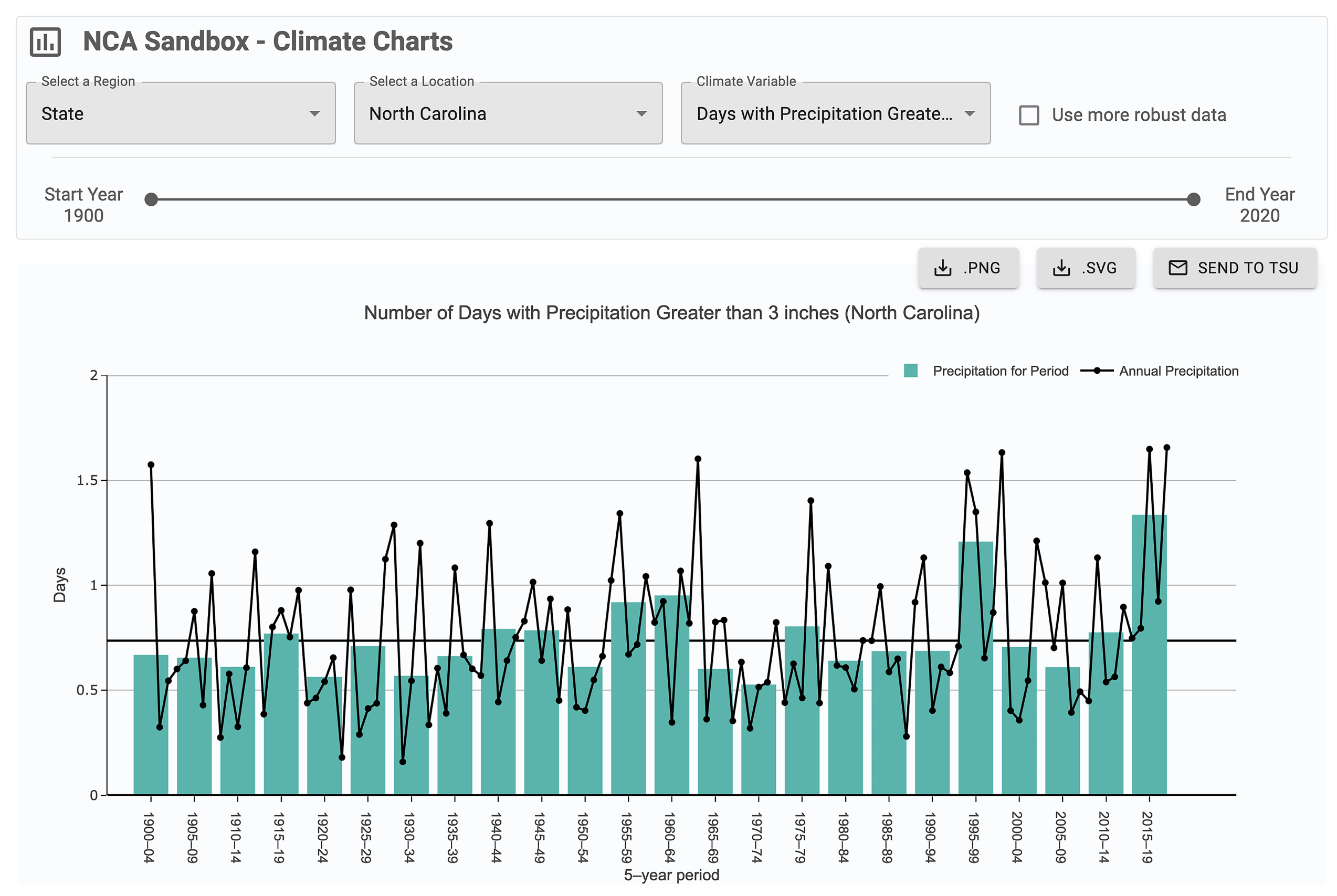
NCA Sandbox
NEMAC partners with NOAA’s Technical Support Unit to create the NCA Sandbox, a tool to help authors create figures for their respective chapters in the National Climate Assessment.
Geospatial Analysis
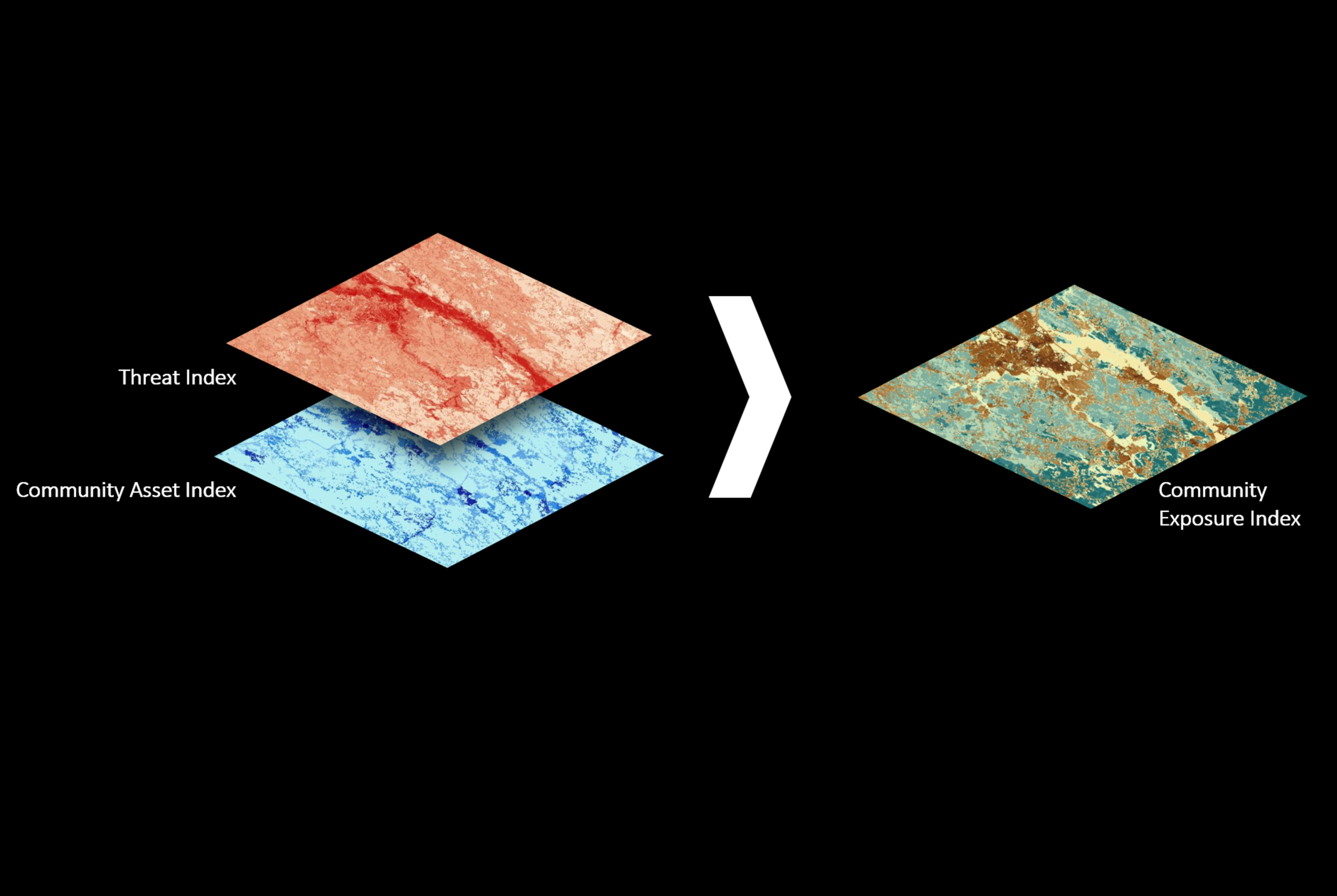
Coastal Resilience Assessments
In 2015, NEMAC partnered with the National Fish and Wildlife Foundation (NFWF) and the National Oceanic and Atmospheric Administration (NOAA) to develop Coastal Resilience Assessments for all U.S. coasts, including Hawaii, the Great Lakes, and all U.S. territories and commonwealths. Using geospatial analysis, multiple datasets from local, state, and federal agencies are combined and standardized to assess flood threats, human community assets, and fish and wildlife habitat to ultimately identify and prioritize areas for resilience and conservation projects that benefit both human and natural communities.
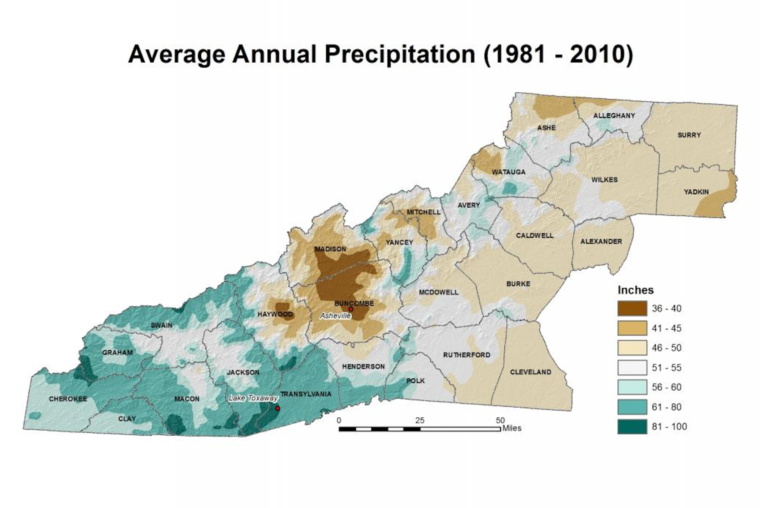
Western North Carolina Vitality Index
The WNC Vitality Index was an online resource providing regional data alongside narrative context to guide the protection of western North Carolina’s resources while promoting healthy economic growth and adaptation to change. The Index was foundational to NEMAC’s work in landscape and community resilience, and was built upon a geospatial analysis and cartography backbone—with regional maps forming much of the data displayed on the site. The website was developed by NEMAC in collaboration with the North Carolina Mountain Resources Commission, the Blue Ridge National Heritage Area, the U.S. Forest Service, and others.
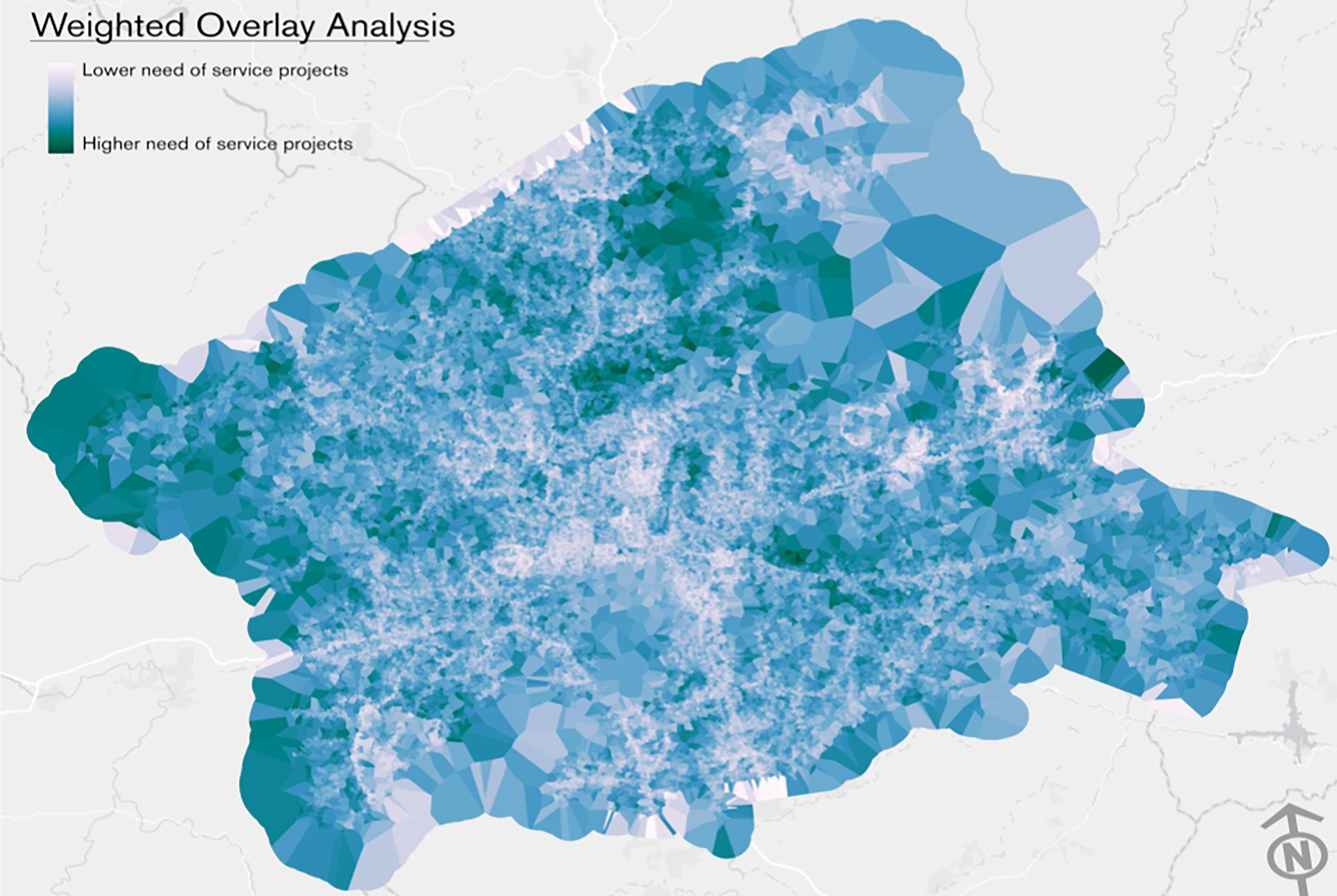
Broadband Service Characterization
The Broadband Service Characterization Project provides tools and processes enabling communities and local governments to identify the gaps in broadband service in western NC. NEMAC, building on a previous project called WestNGN-UNCA, developed an analysis that identified areas most in need of funding projects to improve broadband service.
Remote Sensing
Forest disturbance monitoring tool (ForWarn)
ForWarn is a cutting-edge forest disturbance monitoring system developed by the U.S. Forest Service, NEMAC, and other federal partners. Forest and natural resources managers, decision makers, scientists, and the public can use this system, which uses satellite imagery, to understand potential threats to our nation’s lands.
HiForm
The HiForm research tool uses the power of satellite imagery to monitor forest disturbance impacts to aid in long-term planning. The tool focuses on eastern U.S. forests, with an emphasis on forests in the Southeast and Appalachians. NEMAC works with the U.S. Forest Service’s Eastern Forest Environmental Threat Assessment Center to support HiForm.
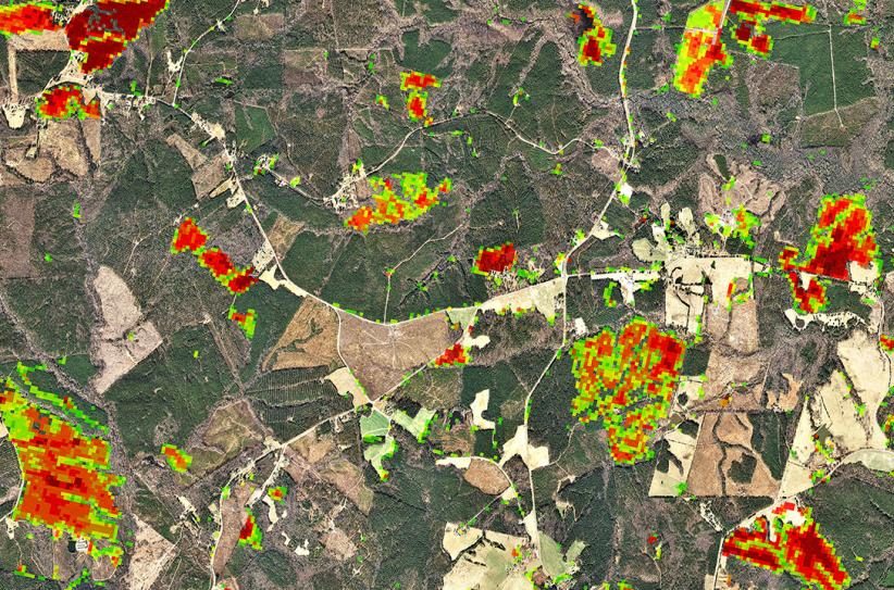
Southern Forest Area Change Tools (SouthFACT)
The Southern Forest Area Change Tools (SouthFACT) is a web-based application for forest change detection utilizing satellite imagery and additional GIS data to identify and quantify changes in forest cover from Virginia to Florida to Oklahoma. NEMAC partnered with the North Carolina Forest Service to develop SouthFACT.
User Research

City of Asheville Resilience Plan
The NEMAC team led City of Asheville staff through the “Steps to Resilience,” a five-step climate-risk planning process developed for the U.S. Climate Resilience Toolkit. The resulting citywide resilience plan to assess and address the effects of climate change was incorporated into Asheville’s 2018 comprehensive plan.

City of Charleston Resilience Plan
In 2019, NEMAC, in partnership with Fernleaf, a large consultant team, and the City of Charleston, assisted in developing a quantified assessment to guide city-wide resilience planning, following the nationally recognized “Steps to Resilience” framework from the U.S. Climate Resilience Toolkit.

Land of Sky Region Economic Resilience Exposure Analysis
The Land of Sky Regional Council of Governments worked, in 2017, with NEMAC to develop a resilience plan for the region’s economic development and transportation assets. By following the “Steps to Resilience” from the U.S. Climate Resilience Toolkit, the resultant report revealed regional assets facing exposure from a changing environment. Land of Sky went on to work with NEMAC’s partner Fernleaf to perform a full vulnerability assessment for the region.
Science Communication
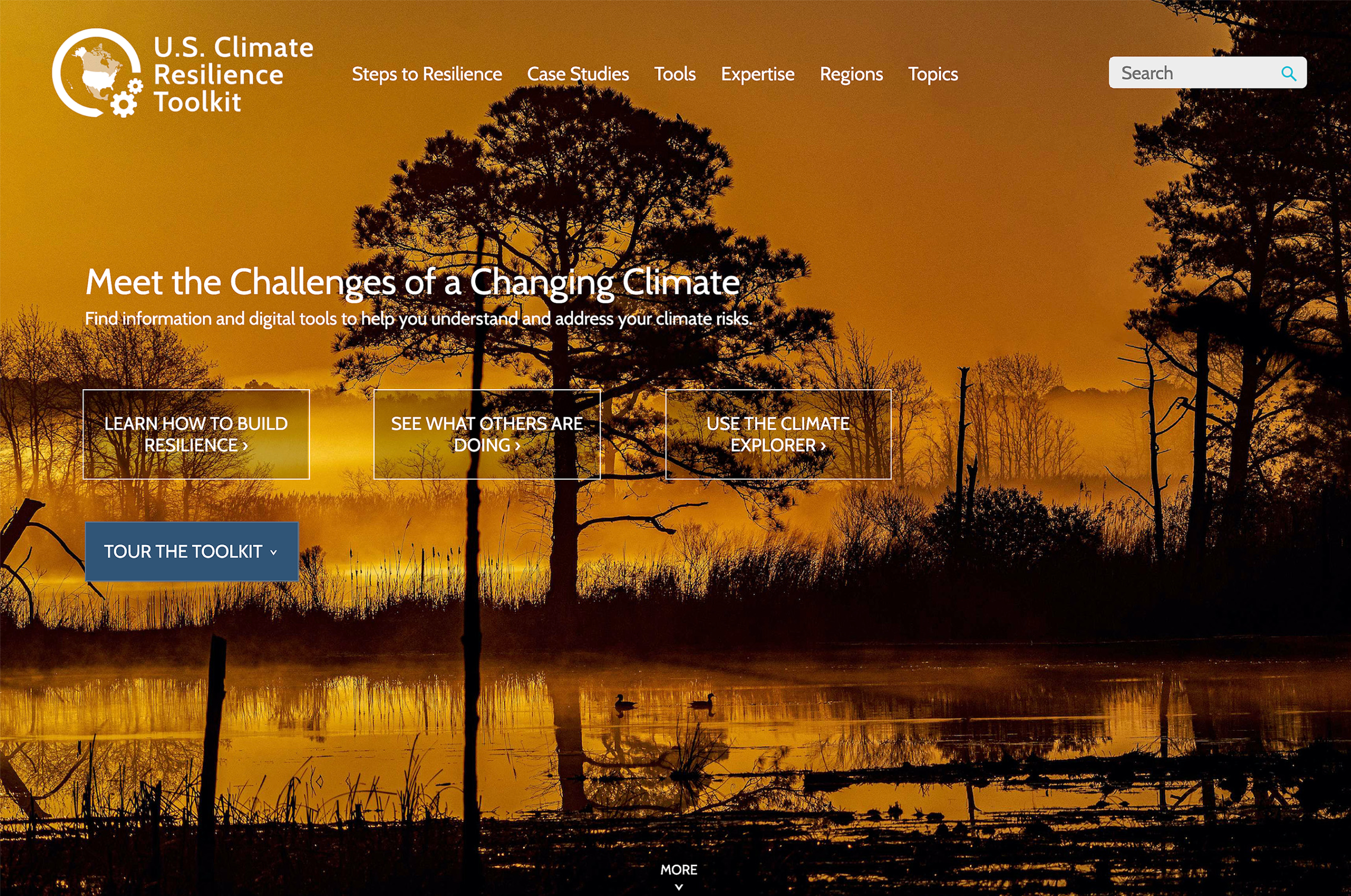
Climate Resilience Toolkit
The U.S. Climate Resilience Toolkit—a Webby Award-nominated website—is a source of scientific tools, information, and expertise to enable people to identify community climate-related risks and take action to build their climate resilience. The site is designed for interested citizens, communities, businesses, resource managers, planners, and policy leaders at all levels of government. The Toolkit is co-developed and co-managed by NEMAC and the National Oceanographic and Atmospheric Administration’s Climate Program Office. The Toolkit includes real-world case studies of climate resilience across the United States and its territories, a catalog of no-cost easy-to-use digital tools, the Steps to Resilience—an effective five-step process used to initiate, plan, and implement community climate resilience projects, and a link to The Climate Explorer.
Climate Indicators
The North Carolina Institute for Climate Studies (NCICS) hosts a platform that delivers key climate information highlighting the Program’s data and providing technical input for reports such as the National Climate Assessment. NEMAC works with the NCICS team to develop static and dynamic graphics that help communicate these key climate messages.
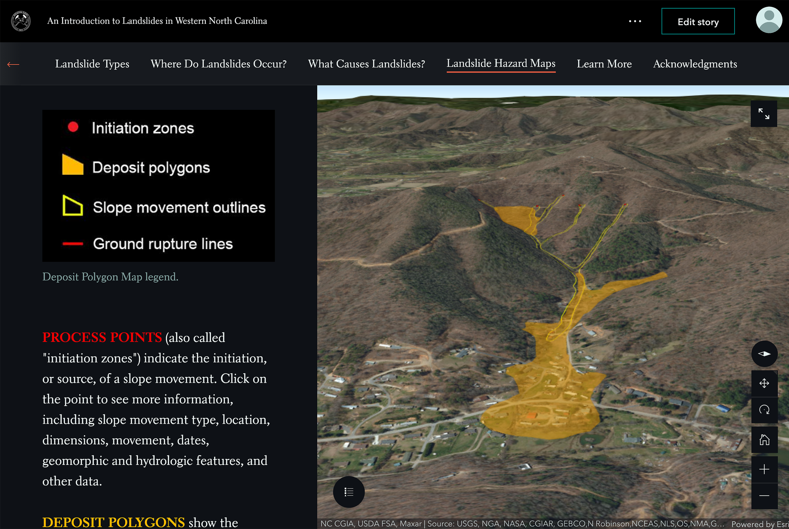
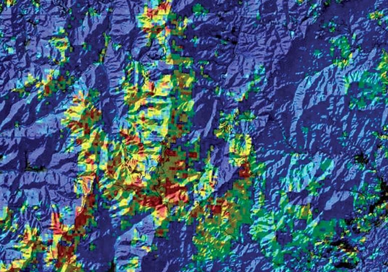
Landslide Hazard Tools
The North Carolina Geological Survey (NCGS), under a 2005 state mandate, is charged with providing maps showing landslide vulnerability in western NC. NEMAC has partnered with the NCGS to support the delivery of accurate landslide hazard data through visualizations, an online map viewer, and guided online stories, making it easy for various audiences to access, interact with, and understand landslide hazard data.
Software Tools
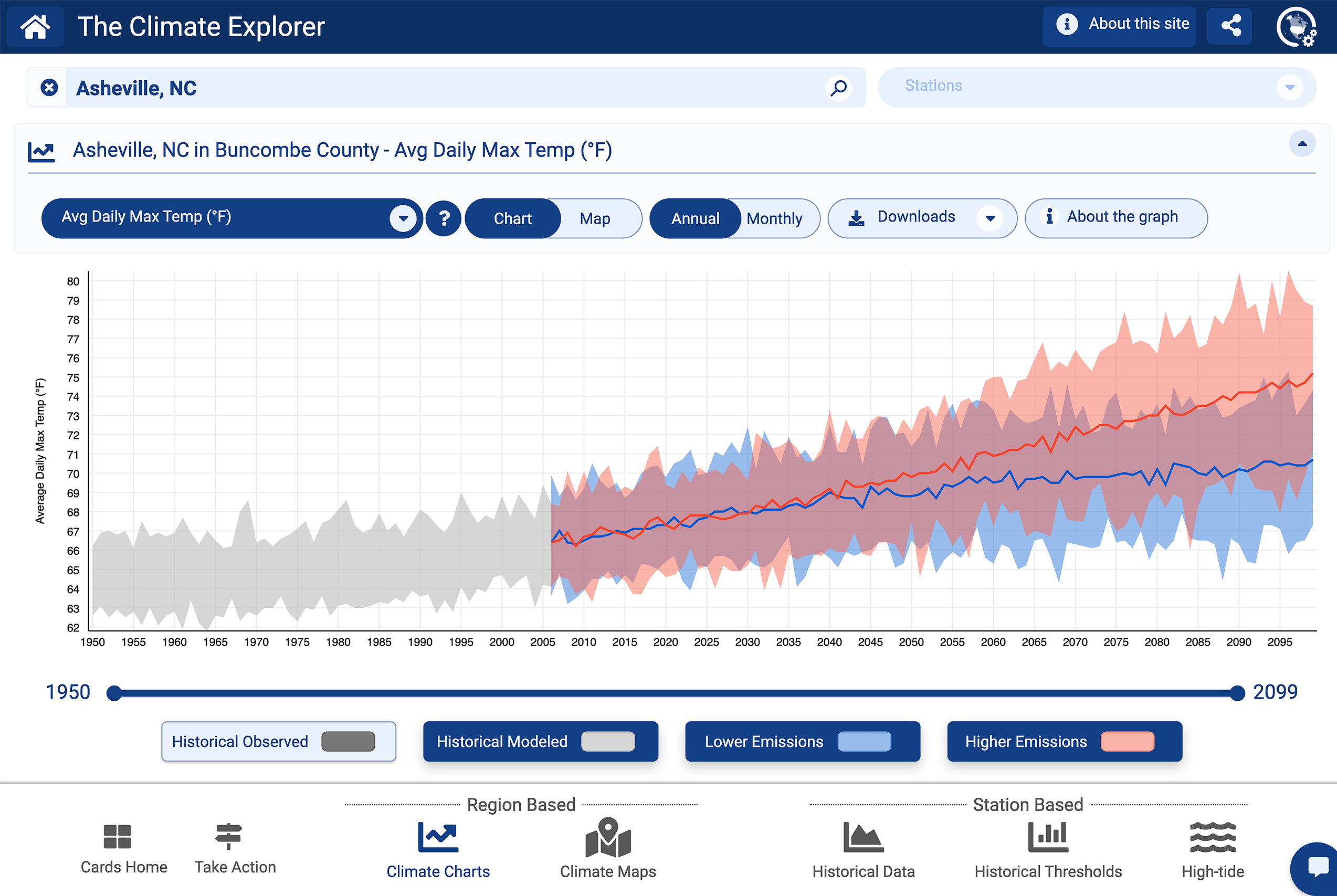
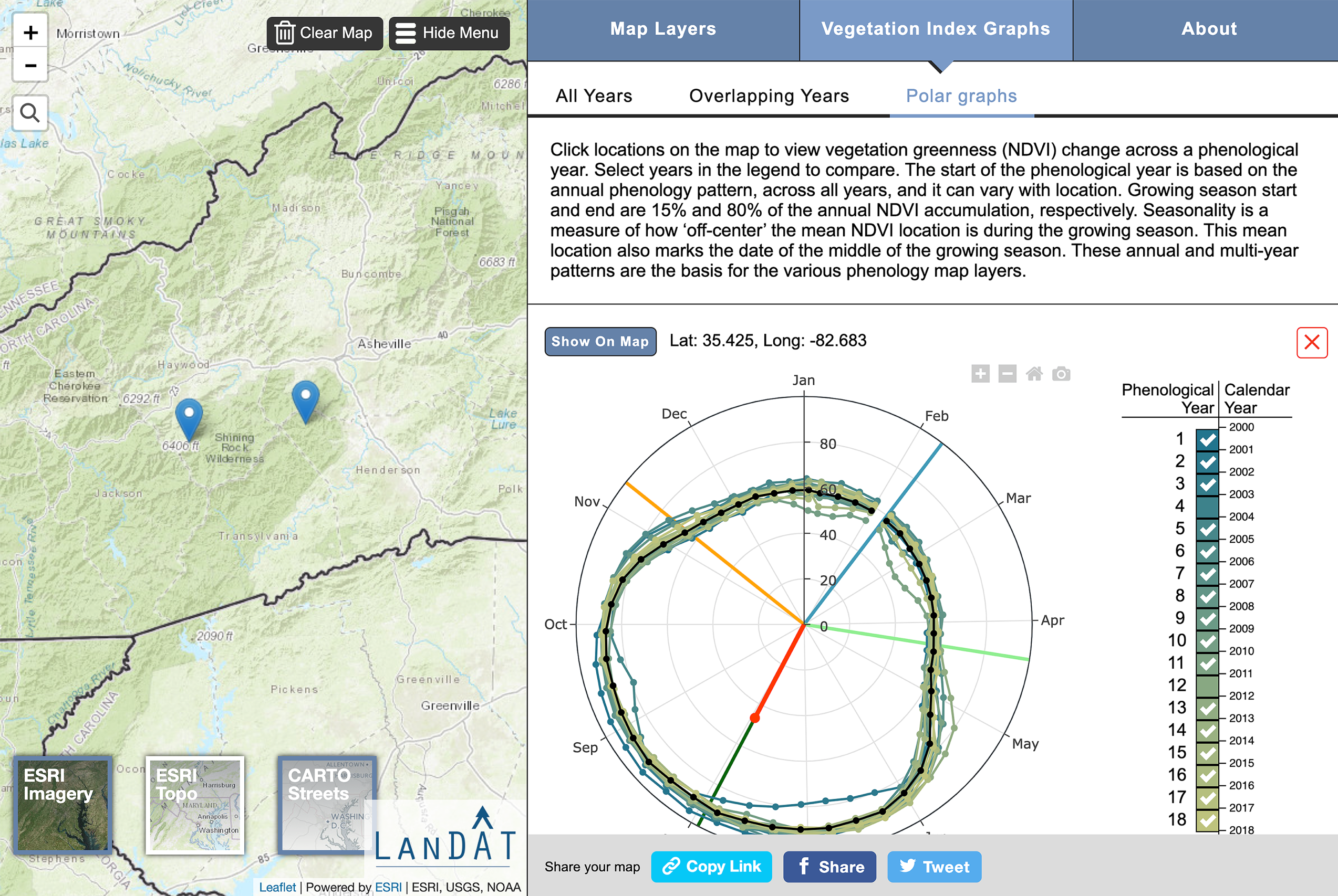
The Climate Explorer
The Climate Explorer is an interactive tool providing graphs, maps, and downloadable data of observed and projected climate conditions for every county in all 50 states and U. S. territories. The climate projection graphs for temperature, precipitation, and related climate variables include ranges of climate model results for two possible futures—one in which humans make a significant attempt to reduce global emissions of heat-trapping gases and one in which the rate of global emissions continues rising through 2100. NEMAC co-developed the Climate Explorer with our partner Fernleaf and a group of federal science agencies led by NOAA’s Climate Program Office.
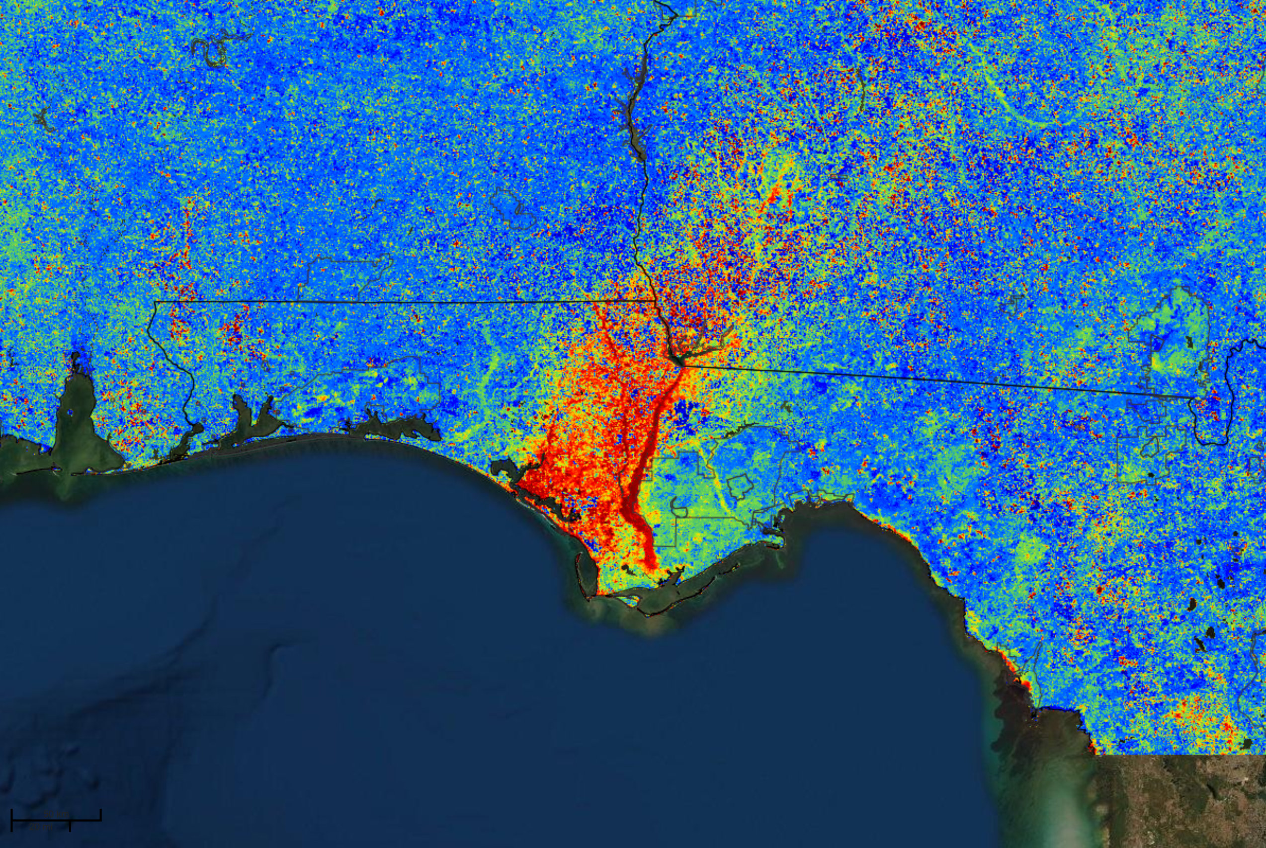
Forest Change Assessment Viewer (FCAV)
The Forest Change Assessment Viewer (FCAV) is an interactive tool that uses high-frequency, moderate-resolution satellite data to provide near real-time change maps of the continental U.S. to understand forest change. NEMAC developed and maintains FCAV in partnership with the U.S. Forest Service’s Eastern Forest Environmental Threat Assessment Center.
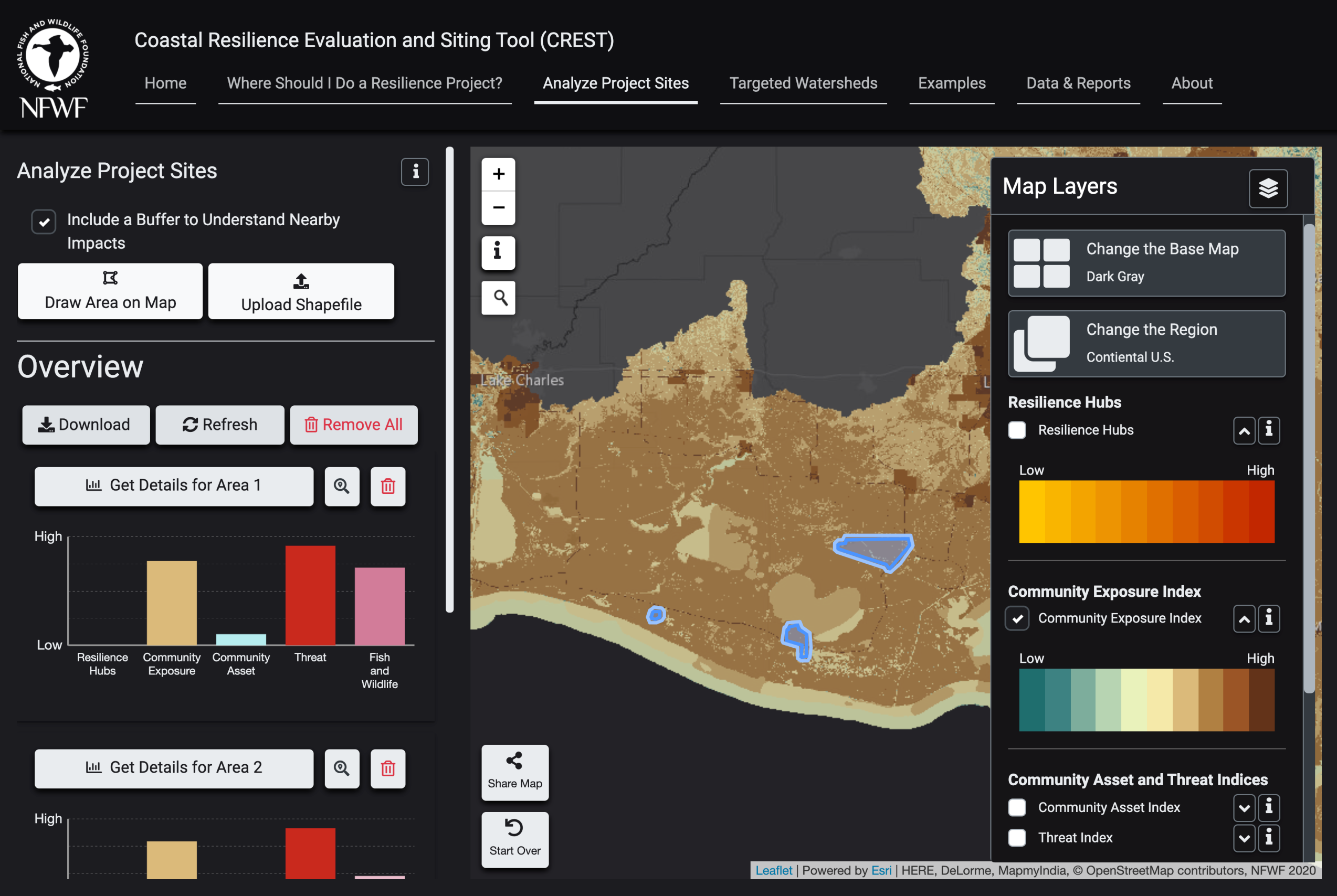
Coastal Resilience Evaluation and Siting Tool (CREST)
The Coastal Resilience Evaluation and Siting Tool (CREST) is an online, interactive platform to access the Regional Coastal Resilience Assessments results developed by the National Fish and Wildlife Foundation (NFWF) in partnership with NOAA, NEMAC, and in consultation with the U.S. Army Corps of Engineers and NatureServe. With CREST, users can interact with Assessment data to identify potential areas for nature-based solutions for coastal resilience that also consider benefits for human communities and fish and wildlife habitats.
Training and Workshops

City of Asheville Resilience workshops
The NEMAC team led City of Asheville staff through a five-step resilience planning process developed for the U.S. Climate Resilience Toolkit called the “Steps to Resilience.” The resulting citywide resilience plan to address the effects of climate change was incorporated into Asheville’s 2018 comprehensive plan.

Steps to Resilience Training
The Steps to Resilience training is a valuable investment of collaboration and time to build long-term community climate resilience. The training guides walk teams through the five-step framework; introduce the data, tools, and support services; and connect like-minded people across the national resilience ecosystem. Experienced trainers come to each site so that teams can navigate the framework in their community and work across city departments to develop solutions.

Partnership for Resilience and Planning (PREP)
Working with the Southeast Sustainability Directors Network and the University of Arkansas, NEMAC helped develop a program that provides education on community resilience planning, promotes network collaboration through workshops, and developed an online Community Resilience Planning Handbook for communities across the Southeast.
User Research
The Climate Explorer
The Climate Explorer tool provides graphs, maps, and downloadable data of observed and projected climate variables for every county and selected territories in the United States. After the tool’s launch, user feedback revealed several issues with the navigation and use of the tool. NEMAC worked with NOAA’S Climate Program Office to perform usability tests that identified user issues, directing efforts to update the tool for a better user experience.
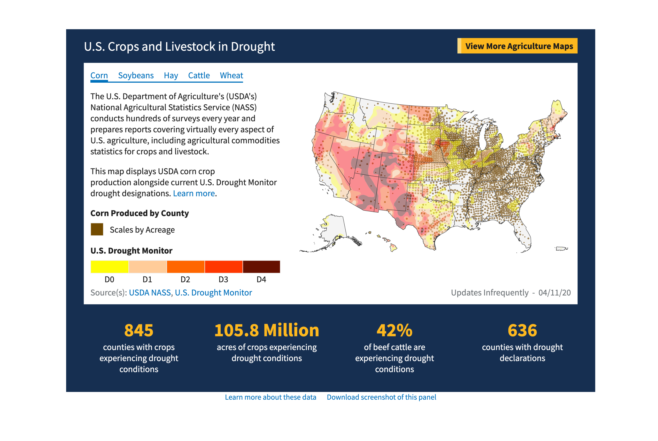
National Integrated Drought Information System (NIDIS)
The National Integrated Drought Information System (NIDIS), or drought.gov, is designed to provide the best available information and tools to assess the potential impacts of, and to prepare for and mitigate the effects of, drought. As part of a 2020 site redesign, NEMAC partnered with the NIDIS team to create new content and to perform usability studies to guide development of the new design.
The Local Climate Analysis Tool (LCAT)
The Local Climate Analysis Tool (LCAT) helps advanced users identify and predict climate-related impacts on water and weather at a local level. NEMAC partnered with the LCAT team to understand who was using the site and how, and in the process identified new audiences for the tool that expanded LCAT’s user base. In addition, NEMAC worked with the LCAT team to understand how people could use the tool to learn more about the effects of drought to expand LCAT’s user base.
Stay Connected With Us
If you have any questions about the type of work that we do, the projects we’ve worked on, or career opportunities available, please send us a message.
Email: nemac@unca.edu
NEMAC on Campus
1 University Heights
236 Rhoades Robinson Hall, CPO#2345
Asheville, NC 28804
NEMAC at Hatch Innovation Hub
45 S French Broad Ave. Suite 170, Asheville, NC 28801
Directions to Hatch Innovation Hub
Available Free Parking